

SURF REPORT · TAGHAZOUT & TAMRAGHT

The waves, today.

Every spot on our coast rated hour by hour from the offshore swell, the wind and the tide, by the rules a surf coach reads them with. The figures come from NOAA and MET Norway; the tide and the sun are computed in the page.

Today

Reading the swell, the wind and the tide…

Offshore swell
—NOAA WaveWatch III
Wind at Taghazout
—MET Norway
Tide
—Computed
Water
—NOAA Coral Reef Watch
Sunrise · sunset
—Computed

Loading the live forecast…

THE MAP

Our coast, spot by spot

Each pin is a spot, filled with its rating. Choose one on the map or in the list for its week; Moonlight and Blue Whale are the gold markers.

Map data © OpenStreetMap contributorsNorth is up
  • Flat
  • Poor
  • Fair
  • Good
  • Very good
  • Epic
  • Our houses

Taghazout, near Moonlight

Tamraght, near Blue Whale

Imi Ouaddar to Cap Ghir

Tamri and Imsouane

THE FORECAST

The week, spot by spot

Today and the next six days at the spot you chose: the estimated height every three hours, then every six once the wind forecast thins out after two and a half days; the period, the wind and the tide. Hover, tap or use the arrow keys on the chart for each hour.

Taghazout, near Moonlight

Panoramas

Taghazout, the point at the south end of the village

Right point, sand and reef, with beach peaks inside. A straight west swell closes the point out.

Level
Beginners on the beach on small days; intermediates on the point
Best tide
Low to mid on the point; the beach works on most tides
Swell direction
Best 300° to 330° (WNW to NNW); works 285° to 345° (WNW to NNW)
Size
Works from 0.8 m of offshore swell, best 1–2.5 m, holds 3 m; beginners 0.5–1 m
Period
10 s at least; 12 s for a classic day
Offshore wind
From 355° to 60° (N to ENE)
Exposure
About 55% of an offshore swell from its best direction reaches it (estimate)
Season
October to April for the point; small in summer
From Moonlight
4–5 min on foot
From Blue Whale
9 min by car
Hazards
  • Rocks at the point
  • Strong currents and rips
  • Crowds

Taghazout, near Moonlight

Hash Point

Taghazout, the rocks at the west end of the village

Mellow right point, sand over rock, into the fishermen’s beach.

Level
Beginners on small days, with a coach; intermediates
Best tide
All tides; low to mid usually best; the rocky entry is tricky at low
Swell direction
Best 295° to 325° (WNW to NW); works 280° to 345° (W to NNW)
Size
Works from 0.8 m of offshore swell, best 1–2 m, holds 2.5 m
Period
10 s at least; 12 s for a classic day
Offshore wind
From 355° to 60° (N to ENE)
Exposure
About 50% of an offshore swell from its best direction reaches it (estimate)
Season
October to April; often flat in summer
From Moonlight
3–5 min on foot
From Blue Whale
8 min by car
Hazards
  • Rocky entry
  • Crowds
  • Water quality after rain

Taghazout, near Moonlight

Anchor Point

Taghazout, the rock headland 1.6 km west-north-west of the village

Long right point over a rock shelf and sand, up to about 500 m.

Level
Intermediates on small clean days (1.2–1.8 m); advanced above about 2 m; experts from 3 m
Best tide
Low to mid, rising; slow at high tide unless the swell is big
Swell direction
Best 295° to 325° (WNW to NW); works 270° to 345° (W to NNW)
Size
Works from 1.2 m of offshore swell, best 1.5–3.5 m, holds 5 m
Period
11 s at least; 14 s for a classic day
Offshore wind
From 345° to 60° (NNW to ENE)
Exposure
About 70% of an offshore swell from its best direction reaches it (estimate)
Season
October to March; best December to February
From Moonlight
20–23 min on foot along the shore road
From Blue Whale
9–10 min by car
Hazards
  • A timed jump off slippery rocks, a hard exit when big
  • Urchins and barnacles on the rocks (wear booties)
  • Current down the point and backwash on big days
  • Crowds

Taghazout, near Moonlight

Mysteries

The back beach just north-west of Anchor PointTake-off placed within about 200 m

Right over a rock shelf with sand, and a short left.

Level
Intermediate to advanced
Best tide
Mid tide; the shelf is too shallow at dead low (sources differ on the rest)
Swell direction
Best 290° to 320° (WNW to NW); works 270° to 330° (W to NNW)
Size
Works from 1 m of offshore swell, best 1.2–2.5 m, holds 3 m
Period
10 s at least; 12 s for a classic day
Offshore wind
From 0° to 70° (N to ENE)
Exposure
About 65% of an offshore swell from its best direction reaches it (estimate)
Season
October to March
From Moonlight
4 min by car, 25–30 min on foot
From Blue Whale
9–10 min by car
Hazards
  • Shallow rock shelf
  • Urchins
  • Rips
  • Crowds

Taghazout, near Moonlight

La Source

In front of the freshwater spring, 800 m north-west of Anchor Point

Reef A-frame: rights toward the cliffs, lefts toward the beach.

Level
Intermediate
Best tide
Mid to high, best on the rising tide; rock slabs show at low
Swell direction
Best 270° to 315° (W to NW); works 240° to 340° (WSW to NNW)
Size
Works from 0.6 m of offshore swell, best 0.8–1.8 m, holds 2.2 m
Period
9 s at least; 11 s for a classic day
Offshore wind
From 350° to 60° (N to ENE)
Exposure
About 65% of an offshore swell from its best direction reaches it (estimate)
Season
All year in small swells; best October to April
From Moonlight
4–5 min by car, about 30 min on foot
From Blue Whale
10 min by car
Hazards
  • Rock slabs at low tide
  • Scattered rocks inside
  • Current

Taghazout, near Moonlight

Killer Point

The headland 1.3 km north-west of Anchor Point, below the N1

Long right point, reef and sand.

Level
Advanced; experts from 3 m
Best tide
All tides; low to mid is easiest; high tide brings the cliffs into play
Swell direction
Best 295° to 325° (WNW to NW); works 270° to 350° (W to N)
Size
Works from 1.2 m of offshore swell, best 1.5–3.5 m, holds 4.6 m
Period
11 s at least; 14 s for a classic day
Offshore wind
From 15° to 100° (NNE to E)
Exposure
About 85% of an offshore swell from its best direction reaches it (estimate)
Season
October to March
From Moonlight
5–6 min by car, about 40 min on foot
From Blue Whale
10–12 min by car
Hazards
  • A 15–20 min paddle, or a jump off sharp rocks
  • Strong current on big days
  • Cliffs at high tide
  • Crowds when it is on

Tamraght, near Blue Whale

Crocro (Imourane)

Tamraght, the long beach north of Devil’s Rock

Beach break over sand, A-frame peaks both ways. Crocro and Imourane are the same beach; the peaks move with the sand.

Level
Beginners when small; intermediates from chest to head high
Best tide
Mid tide, rising; dumpy at dead low
Swell direction
Best 280° to 310° (W to NW); works 225° to 330° (SW to NNW)
Size
Works from 0.4 m of offshore swell, best 0.6–1.5 m, holds 1.8 m; beginners 0.4–1 m
Period
7 s at least; 10 s for a classic day
Offshore wind
From 45° to 115° (NE to ESE)
Exposure
About 80% of an offshore swell from its best direction reaches it (estimate)
Season
All year; beginners best May to October
From Moonlight
9 min by car
From Blue Whale
14–17 min on foot
Hazards
  • Close-outs and shore break above about 1.5 m
  • Rips
  • Surf school crowds

Tamraght, near Blue Whale

Devil’s Rock

Tamraght, the cove between the dark rock and the Banana Point headland

Beach break, sand, rocks at both ends; lefts and rights, and a right off the rock.

Level
Beginner to intermediate
Best tide
Mid; works on most tides, better rising
Swell direction
Best 285° to 315° (WNW to NW); works 225° to 340° (SW to NNW)
Size
Works from 0.4 m of offshore swell, best 0.6–1.5 m, holds 2 m; beginners 0.4–1 m
Period
7 s at least; 10 s for a classic day
Offshore wind
From 40° to 110° (NE to ESE)
Exposure
About 75% of an offshore swell from its best direction reaches it (estimate)
Season
All year; most consistent October to April
From Moonlight
9–10 min by car
From Blue Whale
18–25 min on foot, 4–5 min by car
Hazards
  • Rocks at both ends of the cove
  • Rips near the rocks above about 1.2 m
  • Surf school crowds
  • Urchins on the rocks

Tamraght, near Blue Whale

Banana Point

Aourir, the north side of the river mouth

Right point, sand over rock, peeling into Banana Beach. The inside works below the point’s range: the rating follows the point.

Level
Beginners on the inside on small days; intermediate to advanced on the point from about 1.5 m
Best tide
All tides; the point is best at mid tide, the inside mid to high and rising
Swell direction
Best 285° to 315° (WNW to NW); works 260° to 330° (W to NNW)
Size
Works from 1.2 m of offshore swell, best 1.5–3 m, holds 4.5 m; beginners 0.5–1.2 m
Period
10 s at least; 12 s for a classic day
Offshore wind
From 20° to 80° (NNE to E)
Exposure
About 60% of an offshore swell from its best direction reaches it (estimate)
Season
The point November to March; the inside all year
From Moonlight
10–12 min by car
From Blue Whale
5–6 min by car, 25–30 min on foot
Hazards
  • Rocks and barnacles at the take-off (wear booties)
  • Rip along the rocks, strong when big
  • Crowds and surf schools

Imi Ouaddar to Cap Ghir

Camel Beach (K25)

Imi Ouaddar, 2.3 km north-west of Killer Point, beside the N1Take-off placed within about 200 m

Beach and reef peaks, and a right off the north rocks.

Level
Beginner to intermediate; used when the bay is too big
Best tide
Mid tide (no strong agreement between sources)
Swell direction
Best 285° to 315° (WNW to NW); works 240° to 335° (WSW to NNW)
Size
Works from 0.5 m of offshore swell, best 0.8–1.8 m, holds 2.2 m; beginners 0.5–1 m
Period
8 s at least; 11 s for a classic day
Offshore wind
From 30° to 100° (NNE to E)
Exposure
About 80% of an offshore swell from its best direction reaches it (estimate)
Season
September to April; summer is often too windy
From Moonlight
7–8 min by car
From Blue Whale
12–14 min by car
Hazards
  • Reef patches
  • Open to the wind: it blows out quickly after late morning

Imi Ouaddar to Cap Ghir

Draculas

The south coast of Cap Ghir, 1.7 km east of BoilersTake-off placed within about 200 m

Fast, hollow right over sharp reef.

Level
Experts only
Best tide
Low to mid
Swell direction
Best 290° to 320° (WNW to NW); works 270° to 335° (W to NNW)
Size
Works from 1.2 m of offshore swell, best 1.8–3.5 m, holds 4 m
Period
12 s at least; 14 s for a classic day
Offshore wind
From 320° to 40° (NW to NE)
Exposure
About 90% of an offshore swell from its best direction reaches it (estimate)
Season
November to March
From Moonlight
25 min by car
From Blue Whale
30 min by car
Hazards
  • Sharp, shallow rock
  • Strong rips
  • A difficult entry and exit

Imi Ouaddar to Cap Ghir

Boilers

Cap Ghir, 900 m south-south-east of the lighthouse

Fast right over rock reef, a ship’s boiler at the take-off.

Level
Experts; advanced surfers on small days
Best tide
Low to mid
Swell direction
Best 295° to 330° (WNW to NNW); works 275° to 345° (W to NNW)
Size
Works from 1 m of offshore swell, best 1.5–3 m, holds 4 m
Period
11 s at least; 14 s for a classic day
Offshore wind
From 330° to 60° (NNW to ENE)
Exposure
About 90% of an offshore swell from its best direction reaches it (estimate)
Season
October to March; picks up more swell than Anchor Point
From Moonlight
About 30 min by car
From Blue Whale
About 35 min by car
Hazards
  • Urchins on the entry rocks
  • Shallow reef
  • Strong currents
  • The boiler wreck at the take-off
  • A narrow entry, a hard exit when big

Tamri and Imsouane

Tamri

The Tamri river mouth, 10 km north-north-east of Cap Ghir

Powerful A-frames over sand at the river mouth. The swell magnet when Taghazout is flat; the summer north wind blows it out by late morning.

Level
Intermediates (it is powerful); beginners only when small, with a coach
Best tide
Low to mid, rising
Swell direction
Best 280° to 330° (W to NNW); works 230° to 20° (SW to NNE)
Size
Works from 0.4 m of offshore swell, best 0.6–1.5 m, holds 2 m
Period
7 s at least; 10 s for a classic day
Offshore wind
From 90° to 170° (E to S)
Exposure
About 100% of an offshore swell from its best direction reaches it (estimate)
Season
All year
From Moonlight
40–45 min by car
From Blue Whale
46–50 min by car
Hazards
  • Strong rips from about 1.2 m
  • Heavy shore break

Tamri and Imsouane

Imsouane, The Bay

Imsouane, from the harbour point into the south-facing bay

Very long, mellow right point (up to about 600 m), sand and rock.

Level
Beginners on the inside; beginner to intermediate on the point; longboards
Best tide
Low to mid, rising
Swell direction
Best 290° to 320° (WNW to NW); works 270° to 340° (W to NNW)
Size
Works from 1 m of offshore swell, best 1.5–3 m, holds 4 m
Period
10 s at least; 13 s for a classic day
Offshore wind
From 340° to 60° (NNW to ENE)
Exposure
About 50% of an offshore swell from its best direction reaches it (estimate)
Season
All year; most consistent October to April
From Moonlight
85–100 min by car
From Blue Whale
90–105 min by car
Hazards
  • Crowds and schools
  • Rocks by the harbour take-off
  • Boat traffic

Tamri and Imsouane

Imsouane, Cathedral Point

Imsouane, the exposed side north-west of the village

Right off the north reef point; beach peaks and a left reef inside.

Level
Intermediate to advanced on the point; beginner to intermediate on the beach
Best tide
Low to mid on the point; the beach is better mid to high
Swell direction
Best 285° to 315° (WNW to NW); works 260° to 335° (W to NNW)
Size
Works from 1 m of offshore swell, best 1.2–2.5 m, holds 4 m
Period
10 s at least; 12 s for a classic day
Offshore wind
From 50° to 120° (NE to ESE)
Exposure
About 90% of an offshore swell from its best direction reaches it (estimate)
Season
All year; best October to April
From Moonlight
85–100 min by car
From Blue Whale
90–105 min by car
Hazards
  • Rocks
  • Strong rips
  • Faster and hollower than the Bay

HOW TO READ THE REPORT

Read it like a coach

A forecast is a model, and a rating is a set of rules. Here are both, in plain words, so you can check every number on this page.

The rating, from 0 to 5

  1. FlatNot surfable: under 0.3 m at the spot, or less than half the swell the spot needs to start.
  2. PoorIt breaks, but little lines up: too small or too big, the wrong direction, a short period or the wrong wind.
  3. FairSurfable, with compromises: fine for a lesson or a short session.
  4. GoodWorth the paddle: most things line up.
  5. Very goodEverything lines up but one detail.
  6. EpicEverything lines up, on a groundswell of 12 s or more in the upper half of the spot’s best size: the best this spot gets. Rare, and relative to the spot.

Behind each word, a score out of 10: ten times the five factors a coach checks, below, each from 0.1 to 1. Under 3.5 it is Poor, from 3.5 Fair, from 5.5 Good, from 7.5 Very good, from 9.5 Epic, if the swell is also a groundswell at the spot’s ideal period (12 s at least) in the upper half of its best size. Flat comes first, whatever the rest. A day is judged on its best hour between first light and sunset.

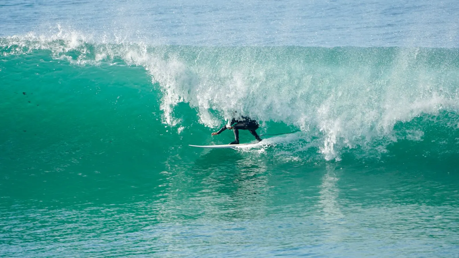
A long right-hander breaking on a big day

What a coach looks at

Size

The offshore swell against the spot’s own range. A beach like Crocro works from 0.4 m and closes out above 1.8 m; Anchor Point needs 1.2 m and holds 5 m. Inside the best range counts in full, inside the working range 0.8, up to a quarter outside it 0.6, further 0.2.

Period

The seconds between two waves, the swell’s power. Under 8 s it is a wind sea, short and soft; from 11 s a groundswell wraps around the points and lines up; 14 s and more makes the classic point days, and heavy sets on the beaches. Up to 2 s short of the spot’s minimum counts 0.7, more 0.4.

Direction

Where the swell comes from. The points of Taghazout want north-west, about 290° to 325°; a straight west swell closes out Panoramas and Hash Point, and from north of about 335° Cap Ghir shadows the bay. Inside the spot’s best window counts in full, falling to 0.6 at the edge of the window it works in, then to 0.1.

Wind

Offshore, from the land, holds the waves up and cleans them; onshore, from the sea, crumbles them. Under 8 km/h it is glassy whatever the side. Mornings are often calm or offshore, and a sea breeze often builds from late morning. Light offshore counts in full, moderate offshore 0.85, light cross-shore 0.6, moderate cross-shore 0.35, moderate onshore 0.1.

Tide

Each spot has its stage: the points and reefs of Taghazout like low to mid, La Source mid to high, the beaches mid. The stage it likes counts in full, the next one 0.7, the opposite one 0.4; a spot that works on all tides keeps 0.85.

Measured offshore, estimated at each spot

The swell is NOAA’s WaveWatch III model at 30.5° N, 10.0° W, about 28 km out to sea: the significant height of all the waves there (the swell and the wind sea together), their peak period and the direction they come from. No model of this scale sees the sandbars, the reefs or the headlands, so the height at each spot is an estimate.

Estimated height = the offshore height × the spot’s exposure (the share of a swell from its best direction that reaches it, in the table) × a direction factor (1 inside its best window, down to 0.6 at the edge of the window it works in, then down to 0.1 over the next 20°) × a period factor (0.8 at 8 s or less, 1.15 at 13 s or more, otherwise 1). The range shown runs from that estimate, the average of the highest third of the waves, to 1.27 times it, the average of the highest tenth: the sets. Read it as an order of size, not a measurement.

The exposures are our research’s first values, set from each spot’s shape and shelter; no source publishes them, and we adjust them as we compare them with the real days.

Each spot: the way it faces, its best swell window and its exposure
SpotFacesBest swellExposure
PanoramasSSW 205°300°–330°55%
Hash PointSSW 205°295°–325°50%
Anchor PointSSW 195°295°–325°70%
MysteriesSSW 210°290°–320°65%
La SourceSSW 200°270°–315°65%
Killer PointSW 225°295°–325°85%
CrocroWSW 255°280°–310°80%
Devil’s RockWSW 245°285°–315°75%
Banana PointSW 220°285°–315°60%
Camel BeachWSW 240°285°–315°80%
DraculasS 175°290°–320°90%
BoilersS 190°295°–330°90%
TamriNW 310°280°–330°100%
Imsouane BaySSW 195°290°–320°50%
Cathedral PointWSW 250°285°–315°90%

Which spot for which level

Beginners

Crocro, Devil’s Rock, Panoramas (the beach), Banana Point (the inside), Camel Beach, Imsouane Bay (the inside), Hash Point (small, with a coach).

When0.3 to 1 m at the spot, wind under 15 km/h, or under 25 km/h offshore; not over 1.5 m, nor a 14 s swell over 1 m.

Intermediates

Hash Point, Panoramas, Banana Point, La Source, Camel Beach, Imsouane Bay; Mysteries, Anchor Point, Cathedral Point and Tamri when small.

When0.8 to 1.8 m at the spot, 10 s or more on the points (8 s on the beaches), wind offshore under 25 km/h or any wind under 12 km/h; not over 2.2 m offshore at the points.

Advanced

Anchor Point, Killer Point, Mysteries, Cathedral Point; Boilers when small, Tamri when big.

When1.8 to 3.5 m offshore from the spot’s best direction, 12 s or more, wind glassy or offshore.

Experts

Boilers and Draculas; Anchor Point and Killer Point from 3 m of offshore swell.

When1.5 to 4 m offshore, 12 s or more, wind glassy or offshore under 20 km/h, the tide the spot likes.

Under each spot, the report shows the levels the hour suits by these rules. They come from our spot research, not from a published local standard: our coaches decide on the day, on the beach, with you.

SOURCES

Where the figures come from

Waves: NOAA WaveWatch III via PacIOOS. Weather and wind: Data from MET Norway (CC BY 4.0). Sea temperature: NOAA Coral Reef Watch. Tide and sun: computed for Taghazout.

Waves
NOAA WaveWatch III, the University of Hawaii’s global run (0.5°, hourly to six days ahead), served by PacIOOS. The cell used is 30.5° N, 10.0° W, about 28 km offshore.
Wind
MET Norway Locationforecast 2.0, at Taghazout, Cap Ghir and Imsouane: every hour for about two and a half days, then every six hours. Speeds converted from m/s to km/h. It gives no gusts for Morocco, so we show none.
Water
NOAA Coral Reef Watch, the daily 5 km satellite sea surface temperature off Taghazout, through PacIOOS: the latest day available, usually yesterday.
Tide
Computed in the page from 25 harmonic constants fitted for Taghazout to two years of the Copernicus Marine sea-level model, and matched to the Agadir tide tables: times within about 15 minutes, heights in metres above chart datum, as in the tables.
Sun
Sunrise, sunset, first and last light computed in the page with NOAA’s solar formulas, for each place.
Map
The coastline and the villages: map data © OpenStreetMap contributors (ODbL). The spots: our research, each take-off checked against four surf guides and the satellite images.
Time
Every time is local time: Morocco, on GMT since 20 September 2026.

Forecasts are models and the heights at the spots are estimates: our coaches decide on the day.

The photographs are ours, taken from the two houses and on the road.